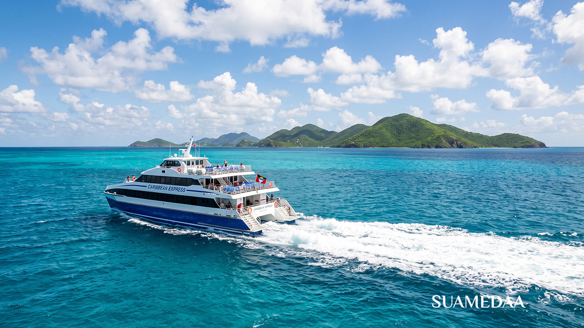
Ferry Routes You Didn’t Know Existed Between Caribbean Islands
Before the runway, there was the sea. For centuries, the Caribbean’s scattered islands were connected not by air bridges and departure lounges but by the water that lies between them, and by the small, purposeful vessels that have crossed those waters since the first islanders paddled between land masses in dugout canoes. The aviation age convinced a generation of travellers that the right way to move between Caribbean islands was to fly, to book a connector flight that vaults you over the very scenery you came to see and deposits you at your next destination without any sense of the journey between.
But the ferries never went away. They simply became invisible to the travelling mainstream, overlooked in favour of the 25-minute island hop that never quite shows you how beautiful the water looks from the surface. Across the Caribbean, from the northern Bahamas to the southern tip of the Grenadines, a network of inter-island ferry routes connects destinations that most visitors never realise can be reached by sea. Some are fast, modern, and run multiple times daily. Others are slower, saltier, and thoroughly unforgettable.
Here are the Caribbean ferry routes you did not know existed, and why you should take them.


Trinidad to Tobago: The Republic’s Own Sea Road
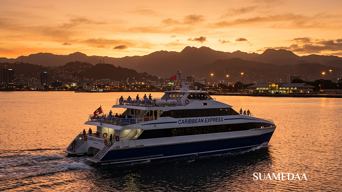
The ferry between Trinidad and Tobago is one of the Caribbean’s best-kept travel secrets for international visitors, partly because the route is so thoroughly integrated into the daily life of Trinidadians that it rarely appears in tourist literature. The Trinidad and Tobago Inter-Island Transportation Company, known as TTIT, operates regular sailings between Port of Spain’s ferry terminal and the deep-water port at Scarborough, Tobago’s capital.
The crossing covers a stretch of the Caribbean Sea and takes approximately three to four hours depending on sea conditions and the vessel deployed. The journey offers something that the 20-minute connecting flight between the two islands cannot: the unhurried experience of watching Trinidad’s mountain-backed coastline diminish behind you and Tobago’s volcanic peaks rise ahead, with nothing but open water and the particular blue of the Caribbean in between.
TTIT vessels offer both economy seating and premium cabin accommodation. The premium cabin sits at the bow of the vessel, with panoramic ocean views through large windows, larger seats, and a quieter atmosphere that makes the crossing feel considerably more comfortable. Light refreshments are available on board. One of the most practically useful features of the service is its vehicle transport capacity: travellers can bring their car across the strait, which transforms Tobago from a short island break into a place you can genuinely explore at your own pace and at your own schedule, without dependence on taxis or rental car availability at the destination.
Booking is strongly recommended in advance, particularly during Tobago’s peak season, public holidays, and the Carnival period when demand on both directions of the route rises sharply. Early morning departures are standard, and the recommendation is to arrive at the ferry terminal at least an hour before sailing.
The Dominican Republic to Puerto Rico: The Newest Long Route
Perhaps the most significant development in Caribbean inter-island ferry travel in recent years is the route that Balearia Caribbean has established between San Pedro de Macoris on the southern coast of the Dominican Republic and the port of Mayaguez on the western coast of Puerto Rico. This is a route that the aviation industry largely monopolised for decades, requiring connections through Santo Domingo or San Juan for what is, geographically, a crossing of 133 miles of open sea.


Balearia, a Spanish ferry company with deep experience in Mediterranean routes and a growing Caribbean operation anchored by its Fort Lauderdale to Bahamas services, launched this Dominican Republic to Puerto Rico route in late 2024. The crossing takes approximately seven hours, which places it in the category of an overnight or daytime ocean crossing rather than a quick hop. The vessel deployed is eco-efficient, designed for combined passenger, vehicle, and cargo transport.
The port investment accompanying this route is substantial. Balearia committed $100 million to the route’s infrastructure, including a new multifunctional passenger terminal in San Pedro de Macoris exceeding 100,000 square metres. The Mayaguez facilities on the Puerto Rican side were adapted to receive the service. The ambition behind this investment reflects the scale of the market being served: the Dominican Republic and Puerto Rico together host tens of millions of residents and receive millions of visitors annually, and connecting the two by sea opens travel and trade possibilities that air travel alone cannot efficiently serve.
For travellers, this route offers the possibility of a genuine island-hopping journey across the northern Caribbean without relying on flights. Puerto Rico’s existing ferry network to Vieques and Culebra extends the chain further.
Puerto Rico to Vieques and Culebra: The Undiscovered Islands at Your Feet
Most travellers who visit Puerto Rico do not realise that two of the most beautiful beaches in the entire Caribbean are accessible by a 30-minute ferry ride from the eastern coast of the island. Vieques and Culebra are offshore islands that sit in the clear water east of Puerto Rico’s mainland, and the ferry service that connects them to the port at Ceiba is among the most remarkable value propositions in Caribbean travel.
The Puerto Rico Ferry, operated by Hornblower, runs services from Ceiba to both islands. Vieques is famous for Bioluminescent Bay, one of the world’s most vivid bioluminescent bodies of water, and for beaches like Playa Flamenco on Culebra that consistently feature on global rankings of the world’s most beautiful stretches of sand. These destinations would attract premium travel packaging and significantly higher costs if they were reached by air charter or private boat. The public ferry makes them accessible for a price that sounds like a misprint: one-way fares for non-resident adults are $2. Children, seniors, and residents pay even less.



The practicalities require attention. Ferry schedules change frequently due to weather, maintenance, and seasonal demand, and only 20 percent of tickets are available for online booking in advance. The remaining tickets are sold at the terminal window, which opens an hour before departure. The recommendation is to arrive at Ceiba at least two hours after leaving San Juan, to allow for the drive east, and to plan your visit during the week rather than the peak weekend period when demand significantly outstrips capacity. Parking at the ferry terminal runs approximately $8 per day.
The crossing in either direction takes about 30 minutes on the faster passenger vessels and 45 minutes on cargo ferries. The journey is a genuine pleasure: the water between Puerto Rico’s eastern coast and the offshore islands is studded with small cays and mangrove outcroppings, and the approach to each island by sea shows it at its most dramatic, the hills rising green from clear water, nothing but the open Caribbean beyond.
The BVI to USVI Crossing: Two Countries, One Short Ride
The water between the British Virgin Islands and the United States Virgin Islands is among the most heavily sailed in the Caribbean, frequented by charter yachts and day-trip vessels, but the public ferry service between the two island groups represents something distinct: a genuine international crossing that can be accomplished in under an hour and that places two very different Caribbean experiences within easy reach of each other.
The most established route connects Road Town, the BVI capital on Tortola, to Charlotte Amalie, the historic Danish colonial capital of St Thomas in the USVI. Four daily sailings each way cover the crossing in approximately one hour. A second route connects Road Town to Red Hook on St Thomas’s eastern end in about 45 minutes with a once-daily morning departure. A third connects Road Town to the island of Virgin Gorda’s Spanish Town across a 25-minute stretch of the Sir Francis Drake Channel, with five sailings Monday through Thursday.
Additional cross-sound services connect Tortola’s West End terminal to Red Hook in about 30 minutes, running three times daily. The practical dimension of these routes is significant: travellers staying in the Virgin Islands can use the ferry network to access the BVI’s extraordinary sailing waters, the caves of the Baths at Virgin Gorda, and the beach bars of Jost Van Dyke without committing to a charter yacht or a multi-day BVI itinerary. And travellers based in the BVI can easily reach St Thomas for the commercial amenities of Charlotte Amalie, including its airport connections, its shopping, and the dining options of a larger population centre.
Bring your passport. The crossing between the BVI and USVI is an international journey, and both departure and arrival require documentation.
The Lesser Antilles Chain: Europe in the Caribbean
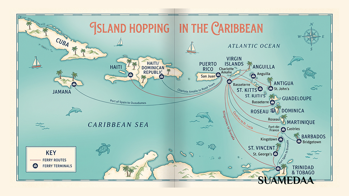
One of the Caribbean’s most remarkable geographical and political facts is that the island chain from Guadeloupe through Dominica to Martinique and Saint Lucia is partly French territory, partly Commonwealth, and entirely connected by a ferry network that makes it possible to island-hop the entire arc by sea without once setting foot on an aircraft. The primary operator on this arc is FRS Express des Iles, the successor operator that has carried passengers across these waters for decades and which makes the crossing between Martinique and Saint Lucia in just 90 minutes.
Starting in Guadeloupe, the overseas department of France that gives the French Caribbean its northern anchor, ferry services radiate southward. Martinique is reached in four and a half to five hours, or via Dominica as an intermediate stop. From Guadeloupe, smaller inner-island services cross to Marie-Galante in one hour with multiple daily sailings, and to the smaller islands of Les Saintes in similarly short crossings.
Dominica sits at the centre of this chain, connected to Guadeloupe to the north in two hours and 30 minutes, to Martinique to the south in two hours, and to Saint Lucia in four hours and 15 minutes. Dominica is the Caribbean’s most ecologically dramatic island, a mountainous, heavily forested national park that rises straight from the sea, and arriving by ferry rather than the tiny airport in the north allows a visitor to appreciate exactly how the island appears when approached from the sea: formidably green, almost primordially so.
From Martinique, a brisk 90-minute crossing reaches Saint Lucia’s Castries harbour, depositing passengers directly in the capital. The crossing between these two islands is one of the most beautiful inter-island ferry journeys in the Caribbean, tracking along Martinique’s southern coast with its bays and fishing villages before the open sea crossing and the approach to Saint Lucia’s Pitons, those twin volcanic spires that are among the most dramatic geographical sights in the region and which appear as the ferry rounds the southern end of the island.
The practical advantage of the ferry network on this French Caribbean arc is also the environmental one: ferry travel produces approximately three times less carbon dioxide than the equivalent flight. For island-hoppers with a conscience about aviation emissions, the ferry is both the more scenic and the more responsible choice.
Grenada to Carriacou and Petite Martinique: The Three-Island Nation
Grenada is officially a three-island nation, and most visitors to the Spice Island never see the other two. Carriacou and Petite Martinique are outer islands to the north of Grenada’s main landmass, connected by the ferry service operated by Osprey Lines from the Carenage, Grenada’s beautiful inner harbour in St George’s, the island’s capital.
The Osprey Lines service takes approximately one and a half to two hours to Carriacou’s Tyrell Bay under calm conditions, with an extension to Petite Martinique adding another 30 minutes. The service departs from the Carenage at the heart of St George’s, one of the Caribbean’s most charming capital waterfronts, and tickets are bought directly at the dock. There is no advance booking requirement and no luggage surcharge.
Carriacou, population around 8,000, is the largest of the outer islands and a world away from Grenada’s more developed tourist infrastructure. The island is famous for its boat-building tradition, its annual Regatta, and its beaches. Hillsborough, the island’s capital, has a relaxed pace that feels approximately 30 years behind the Caribbean mainstream, in the best possible sense. Sandy Island, a few minutes by water taxi from Carriacou, is a sandspit with one coconut palm and some of the most transparent snorkelling water in the region.
Petite Martinique, even smaller, is a fishing and boat-building community that receives very few visitors and has no tourist infrastructure to speak of. The crossing from Carriacou by local ferry takes 30 minutes twice daily on weekdays. Arriving here is as close as the contemporary Caribbean offers to stepping entirely outside the tourist circuit.
On the Osprey Lines vessel, a covered interior with air conditioning and an open upper deck provide the choice of comfort or breeze. The recommendation for those susceptible to seasickness is the interior mid-ship seating; those who want the Caribbean’s famous sky in full panorama take the upper deck and accept the trade-off. The round-trip fare is approximately EC$80 each way.
St Kitts to Nevis: The Two-Island Federation
St Kitts and Nevis form a federation of two islands separated by a two-mile channel called The Narrows. The crossing between them takes about 20 minutes and runs multiple times daily, making the two islands as accessible to each other as a short bus journey. For visitors to either island, the ferry is the practical means of day-tripping to the other.
Nevis is the quieter, more intimate sibling: a single volcanic cone rising from the sea, its peak frequently shrouded in cloud, its lower slopes covered in estates and plantation great houses. The island is famous as the birthplace of Alexander Hamilton and for a level of tourist development that is deliberately restrained. The few hotels on Nevis are small, elegant, and expensive. The beaches are uncrowded. The atmosphere is that of a Caribbean island that has resisted the pressure to expand its tourist capacity beyond what its character can absorb.
The St Kitts ferry network extends further than Nevis, however. Services also run from Port Zante in Basseterre to St Eustatius and to Saba, two Dutch Caribbean islands that sit north of St Kitts and represent an entirely different cultural and ecological experience. Saba is a single volcanic peak that rises from the sea to 887 metres at the summit of Mount Scenery, contains no beaches at all, and is home to a diving community that considers its undersea marine park among the best dive sites in the Caribbean. The ferry from St Kitts to Saba runs on selected days and takes approximately two and a half hours.
Antigua to Barbuda: The Pink Beach That Requires Planning
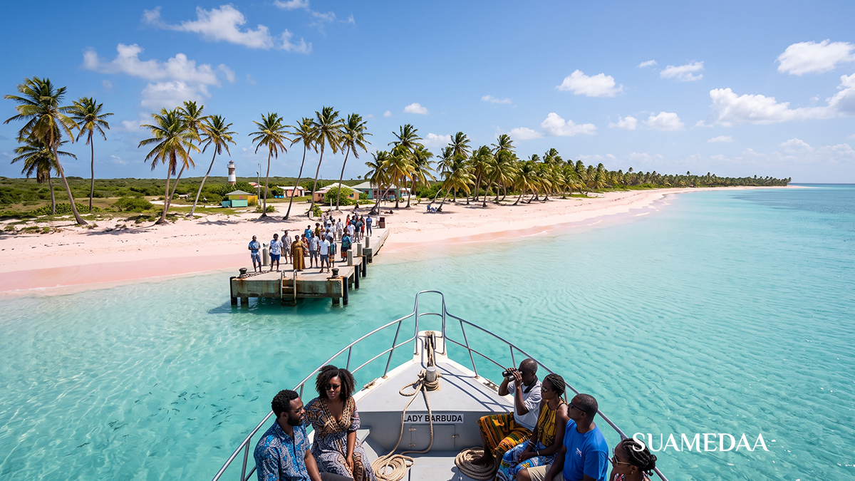
Barbuda is the sister island of Antigua in the same federation, but it is a place that most visitors to Antigua never reach. It sits 27 miles north of its larger neighbour, a flat coral island of about 62 square miles, and it offers what is genuinely one of the Caribbean’s most extraordinary beaches: a 17-mile sweep of pink sand that remains undeveloped, uncrowded, and as close to primeval as the Caribbean coastal landscape gets.
The Barbuda Express operates the ferry service between St John’s Harbour in Antigua and the Barbuda pier, with crossings on Monday, Tuesday, Thursday, and Friday departing at 8:30am and returning at 4:30pm. Wednesday runs two daily crossings. The journey takes 90 minutes each way. Round-trip fares with an organised tour run to approximately US$164 per person, including a taxi island tour, a visit to the Frigate Bird Sanctuary (one of the largest colonies of magnificent frigatebirds in the Western Hemisphere, with 5,000 birds), and a lobster lunch on the beach.
Barbuda is quiet in a way that its more famous neighbour is not. The island’s population barely exceeds 1,800 people. Hurricane Irma’s direct hit in 2017 caused catastrophic damage that required the full evacuation of the island and a multi-year rebuilding process. The island has recovered, but it still carries a rawness and genuineness that distinguishes it from the more developed Caribbean experience. The pink sand beach, coloured by crushed coral and shell, stretches without interruption for distances that feel implausible in a region where beach real estate is so commercially contested.
The Cayman Islands’ Inner Waters
The Cayman Islands are better known as an offshore financial centre and a port of call for large cruise ships than as a ferry destination, but within the islands themselves, a small-boat network connects George Town with the quieter waterways and communities that visitors rarely see.
Services from Camana Bay, the planned community development on the west side of Grand Cayman, run to Kaibo and Rum Point on the island’s northern shore in 36 minutes, and to Newlands on the southern coast in 20 minutes, with multiple daily sailings except Mondays. These routes serve both residents commuting between different parts of the island and visitors who want to reach the relatively undeveloped northern coast by water rather than by road.
Rum Point, at the end of one of these crossings, sits on a quiet lagoon with a beach bar and hammocks strung between palms over the water. Reaching it by ferry from Camana Bay rather than by the 45-minute drive around the island’s eastern interior road gives the journey a character it would otherwise lack.
The Turks and Caicos Island Hop: Provo to the Quiet Islands
Providenciales, known universally as Provo, is the main tourist hub of the Turks and Caicos Islands, home to the Grace Bay hotel strip and the famous Grace Bay Beach. Thirty minutes away by ferry across the shallow Caicos Bank lies North Caicos, a quiet island of about 1,500 people that sees a fraction of the visitors who fill Provo’s resorts but offers some of the most spectacular flamingo-watching, birdlife, and empty coastline in the entire island chain.
Two operators run the Providenciales to North Caicos crossing: Caribbean Cruisin, which operates the majority of daily sailings and charges approximately $70 for an adult round trip, and the smaller MV My Girl, which runs a 12-to-15-passenger vessel on a less frequent schedule. The departure terminal at Providenciales is Heaving Down Rock Marina at the eastern end of Leeward Highway, and arrival is at Bellefield Landing on North Caicos, where a restaurant and gift shop provide immediate orientation.
The crossing itself is a scenic pleasure, tracking along the exquisite Caicos Cays and passing close to Parrot Cay, Pine Cay, and Water Cay, islands whose shallow turquoise waters and mangrove fringing are exactly the Caribbean of a photograph and rarely the Caribbean of a traveller’s actual experience. The passage from Provo to North Caicos offers 25 minutes of it.
From North Caicos, a causeway connects to Middle Caicos, the largest island in the Turks and Caicos by land area and the least visited. The limestone cave system at Conch Bar Caves, the longest cave system in the entire Caribbean, sits on Middle Caicos and is accessible only to those who have made the ferry crossing to North Caicos and driven the connecting causeway.
Further south, a twice-weekly ferry connects Providenciales to South Caicos in under two hours, and Monday, Wednesday, and Friday crossings link Salt Cay to Grand Turk in about an hour, the latter a crossing between two of the smallest and most historically significant settlements in the Turks and Caicos.
Saint Vincent and the Grenadines: The Ferry Chain of the South
The chain of islands that runs south from Saint Vincent through Bequia, Canouan, Mayreau, and Union Island represents one of the Caribbean’s most compelling island-hopping itineraries, and ferry travel is both the traditional and the most practical way to navigate it. The sea road through the Grenadines was the original transport corridor of this archipelago, and taking it in the direction the ferries run, from Kingstown south through the chain, is still the best way to appreciate how the Grenadines work.
The St Vincent to Bequia route is the most frequent and reliable of the chain. Two operators, Bequia Express and Admiral Ferry, run multiple daily crossings covering the journey in about an hour. Bequia, population around 5,000, is an island with a deep sailing tradition, a vibrant arts scene, and an atmosphere that manages to feel authentic and inhabited while still welcoming visitors. The approach to Port Elizabeth by ferry, with the harbour full of sailing yachts and the painted wooden buildings rising from the waterfront, is one of the Caribbean’s most immediately appealing harbour arrivals.
The Jaden Sun Fast Ferry continues the chain south from Saint Vincent through Bequia, Canouan, Mayreau, and Union Island on selected days, reaching Union Island in about two and a half to three hours of sailing with short stops at each intermediate island. Union Island is the jumping-off point for the Tobago Cays, a marine park whose five uninhabited islands and coral reef constitute what many sailors and divers consider the single most beautiful spot in the entire Caribbean. Service on this route operates on Sundays, Mondays, and Fridays, and the line has experienced interruptions, so checking current schedules before planning around it is essential.
An alternative slower service, the MV Gem Star II, runs twice weekly from Kingstown through Mayreau and Canouan to Union Island, a vessel that predates the fast ferry era and provides an experience of inter-island travel that feels genuinely old-school, arriving at each island at the pace and scale of the Caribbean before the tourism industry reshaped it.
What to Know Before You Board
Caribbean ferry travel is not like ferry travel in Northern Europe, where timetables are published years in advance, vessels arrive and depart with clock-like precision, and online booking closes every available seat days before departure. It is altogether more human, more flexible, and more weather-dependent than its European equivalent, and the traveller who approaches it with that understanding will have a better experience than the one who expects the same reliability as a scheduled flight.
Schedules change. Seasonal adjustments, weather events, vessel maintenance, and public holidays all affect departure times and frequencies across the region. The practice of checking the operator’s official website, Facebook page, or local tourist office within a few days of your planned crossing is not optional caution but practical necessity.
Cash is preferred across most of the smaller routes and islands, though the larger operators like Balearia Caribbean, the BVI ferry companies, and Barbuda Express accept cards. The Eastern Caribbean Dollar is the currency of most of the Lesser Antilles islands, and many operators will accept both EC dollars and US dollars, but change may be returned in whichever currency the operator keeps on hand.
Bring your passport on any route that crosses an international boundary, which includes the BVI to USVI crossing, the Dominican Republic to Puerto Rico service, and any movement between islands in different territorial jurisdictions. Even within the Lesser Antilles chain, where island-hopping between French, British, and independent Caribbean territories is seamless in practice, a passport is the essential document.
Seasickness is real on Caribbean ferry crossings. The open Caribbean Sea has swells, and ferries that cross it are not as insulated from those swells as larger vessels. The standard practical advice applies: sit mid-ship on the lower deck, face the horizon, stay hydrated, avoid heavy meals immediately before boarding, and consider an over-the-counter remedy like Dramamine if you have any susceptibility. The crossing from Grenada to Carriacou, the Dominica to Saint Lucia run, and the longer Dominican Republic to Puerto Rico route are among those where sea conditions most frequently test passengers.
The reward for managing the logistics and the occasional chop is a mode of travel that aviation has made almost entirely unavailable in the modern Caribbean: the experience of arriving at an island by sea, watching the land grow from a line on the horizon to a full and present landscape, entering a harbour rather than descending through clouds to a runway. It is, for most visitors who try it, a revelation of what Caribbean travel can feel like when the sea is not just the backdrop but the journey itself.